![](/images/other/stat-length.png)
![Tocht Stappen Les Damps - marche du 15 juillet - Photo](https://media.geolcdn.com/t/1900/400/ext.pjpeg?maxdim=2&url=https%3A%2F%2Fservices.sitytrail.com%2FGeolivesWS%2FDownloadMedia.ashx%3FTrailID%3D139243%26Media%3D20120715152707.jpg)
marche du 15 juillet
wallander76
Gebruiker
![Lengte](/images/other/stat-length.png)
Lengte
24 km
![Max. hoogte](https://static1.geolcdn.com/siteimages/upload/files/1508320355ic_sort_altitude_max_24dp.png)
Max. hoogte
147 m
![Positief hoogteverschil](https://static1.geolcdn.com/siteimages/upload/files/1508320355ic_sort_den_pos_24dp.png)
Positief hoogteverschil
410 m
![Km-Effort](/images/other/stat-length.png)
Km-Effort
29 km
![Min. hoogte](https://static1.geolcdn.com/siteimages/upload/files/1508320355ic_sort_altitude_min_24dp.png)
Min. hoogte
27 m
![Negatief hoogteverschil](https://static1.geolcdn.com/siteimages/upload/files/1508320355ic_sort_den_neg_24dp.png)
Negatief hoogteverschil
408 m
![Boucle](https://static1.geolcdn.com/siteimages/upload/files/16400158638029165_repeat_loop_refresh_sync_direction_icon.png)
Boucle
Ja
Datum van aanmaak :
2014-12-10 00:00:00.0
Laatste wijziging :
2014-12-10 00:00:00.0
![Stappen](https://static1.geolcdn.com/sitytour/trail-icons/101.png)
3h38
Moeilijkheid : Onbekend
![Scan deze QR-code om de tocht te openen in de SityTrail-applicatie](https://capi.geolives.com/qq0zvz2zws4bq2lad0pu/sitytour/trails/139243/qr.png?size=200)
Gratisgps-wandelapplicatie
Over ons
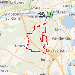
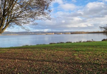
Tocht Stappen van 24 km beschikbaar op Normandië, Eure, Les Damps. Deze tocht wordt voorgesteld door wallander76.
Beschrijving
Après une semaine très calme, j'avais vraiment besoin de faire un peu d'exercice. J'ai pu profiter d'une météo clémente ce qui était une denrée rare ces derniers temps. Je crois que j'ai trouvé à peu près toutes les montées et descentes de la forêt.
Plaatsbepaling
Land:
France
Regio :
Normandië
Departement/Provincie :
Eure
Gemeente :
Les Damps
Locatie:
Unknown
Vertrek:(Dec)
Vertrek:(UTM)
367209 ; 5462164 (31U) N.
Opmerkingen
Wandeltochten in de omgeving
![Tocht Stappen Sotteville-sous-le-Val - Sotteville sous le Val vers Igoville - Photo](https://media.geolcdn.com/t/375/260/ext.jpg?maxdim=2&url=https%3A%2F%2Fservices.sitytrail.com%2FGeolivesWS%2FDownloadMedia.ashx%3FTrailID%3D954232%26Media%3Dfix__20180427145133.jpg)
![Stappen Stappen](https://static1.geolcdn.com/sitytour/trail-icons/101.png)
Sotteville sous le Val vers Igoville
Stappen
Gemakkelijk
(1)
Sotteville-sous-le-Val,
Normandië,
Seine-Maritime,
France
![](/images/other/stat-length.png)
8,7 km | 9,3 km-effort
1h 48min
![](https://static1.geolcdn.com/siteimages/upload/files/16400158638029165_repeat_loop_refresh_sync_direction_icon.png)
Ja
![Tocht Trail Les Damps - 20190820_135035 - Photo](https://media.geolcdn.com/t/375/260/ext.jpg?maxdim=2&url=https%3A%2F%2Fstatic1.geolcdn.com%2Fsiteimages%2Fupload%2Ffiles%2F1524743154running.jpg)
![Trail Trail](https://static1.geolcdn.com/sitytour/trail-icons/104.png)
20190820_135035
Trail
Heel gemakkelijk
(1)
Les Damps,
Normandië,
Eure,
France
![](/images/other/stat-length.png)
10,9 km | 12,5 km-effort
Onbekend
![](https://static1.geolcdn.com/siteimages/upload/files/16400158638029165_repeat_loop_refresh_sync_direction_icon.png)
Ja
![Tocht Stappen Pont-de-l'Arche - Pont de l'Arche/ Les Damps (126) - Photo](https://media.geolcdn.com/t/375/260/ext.jpg?maxdim=2&url=https%3A%2F%2Fstatic1.geolcdn.com%2Fsiteimages%2Fupload%2Ffiles%2F1553511878bg_sport_marche.png)
![Stappen Stappen](https://static1.geolcdn.com/sitytour/trail-icons/101.png)
Pont de l'Arche/ Les Damps (126)
Stappen
Medium
(4)
Pont-de-l'Arche,
Normandië,
Eure,
France
![](/images/other/stat-length.png)
11,5 km | 13,9 km-effort
3h 3min
![](https://static1.geolcdn.com/siteimages/upload/files/16400158638029165_repeat_loop_refresh_sync_direction_icon.png)
Ja
![Tocht Stappen Les Authieux-sur-le-Port-Saint-Ouen - *les Authieux Igoville 15km - Photo](https://media.geolcdn.com/t/375/260/acace470-e678-4207-9fe1-f083d26db0f1.jpg&format=jpg&maxdim=2)
![Stappen Stappen](https://static1.geolcdn.com/sitytour/trail-icons/101.png)
*les Authieux Igoville 15km
Stappen
Heel gemakkelijk
(1)
Les Authieux-sur-le-Port-Saint-Ouen,
Normandië,
Seine-Maritime,
France
![](/images/other/stat-length.png)
13,9 km | 16,5 km-effort
3h 37min
![](https://static1.geolcdn.com/siteimages/upload/files/16400158638029165_repeat_loop_refresh_sync_direction_icon.png)
Ja
![Tocht sport Le Vaudreuil - Du Vaudreuil, aux Andelys et retour - Photo](https://media.geolcdn.com/t/375/260/20c8ffda-31e3-4118-abb6-292e764a0bf3.jpg&format=jpg&maxdim=2)
Du Vaudreuil, aux Andelys et retour
sport
Heel gemakkelijk
Le Vaudreuil,
Normandië,
Eure,
France
![](/images/other/stat-length.png)
58 km | 64 km-effort
Onbekend
![](https://static1.geolcdn.com/siteimages/upload/files/16400158638029165_repeat_loop_refresh_sync_direction_icon.png)
Ja
![Stappen Stappen](https://static1.geolcdn.com/sitytour/trail-icons/101.png)
20240305-Gouy
Stappen
Medium
Les Authieux-sur-le-Port-Saint-Ouen,
Normandië,
Seine-Maritime,
France
![](/images/other/stat-length.png)
10,7 km | 13,1 km-effort
2h 35min
![](https://static1.geolcdn.com/siteimages/upload/files/16400158638029165_repeat_loop_refresh_sync_direction_icon.png)
Ja
![Stappen Stappen](https://static1.geolcdn.com/sitytour/trail-icons/101.png)
20240227-Poses
Stappen
Gemakkelijk
Amfreville-sous-les-Monts,
Normandië,
Eure,
France
![](/images/other/stat-length.png)
13,1 km | 14,1 km-effort
2h 49min
![](https://static1.geolcdn.com/siteimages/upload/files/16400158638029165_repeat_loop_refresh_sync_direction_icon.png)
Ja
![Tocht Stappen Sotteville-sous-le-Val - 20240206-Sotteville sous le Val - Photo](https://media.geolcdn.com/t/375/260/10e7cce0-0471-4b6b-b343-86046b8aac60.jpg&format=jpg&maxdim=2)
![Stappen Stappen](https://static1.geolcdn.com/sitytour/trail-icons/101.png)
20240206-Sotteville sous le Val
Stappen
Medium
Sotteville-sous-le-Val,
Normandië,
Seine-Maritime,
France
![](/images/other/stat-length.png)
11,4 km | 13,5 km-effort
2h 34min
![](https://static1.geolcdn.com/siteimages/upload/files/16400158638029165_repeat_loop_refresh_sync_direction_icon.png)
Ja
![Tocht Stappen Les Damps - 20231212-Les Damps - Photo](https://media.geolcdn.com/t/375/260/9b98702f-b952-4d47-95e5-e5dc435553fd.jpg&format=jpg&maxdim=2)
![Stappen Stappen](https://static1.geolcdn.com/sitytour/trail-icons/101.png)
20231212-Les Damps
Stappen
Medium
Les Damps,
Normandië,
Eure,
France
![](/images/other/stat-length.png)
9,5 km | 11,1 km-effort
2h 39min
![](https://static1.geolcdn.com/siteimages/upload/files/16400158638029165_repeat_loop_refresh_sync_direction_icon.png)
Ja